Pitt Street Modelling

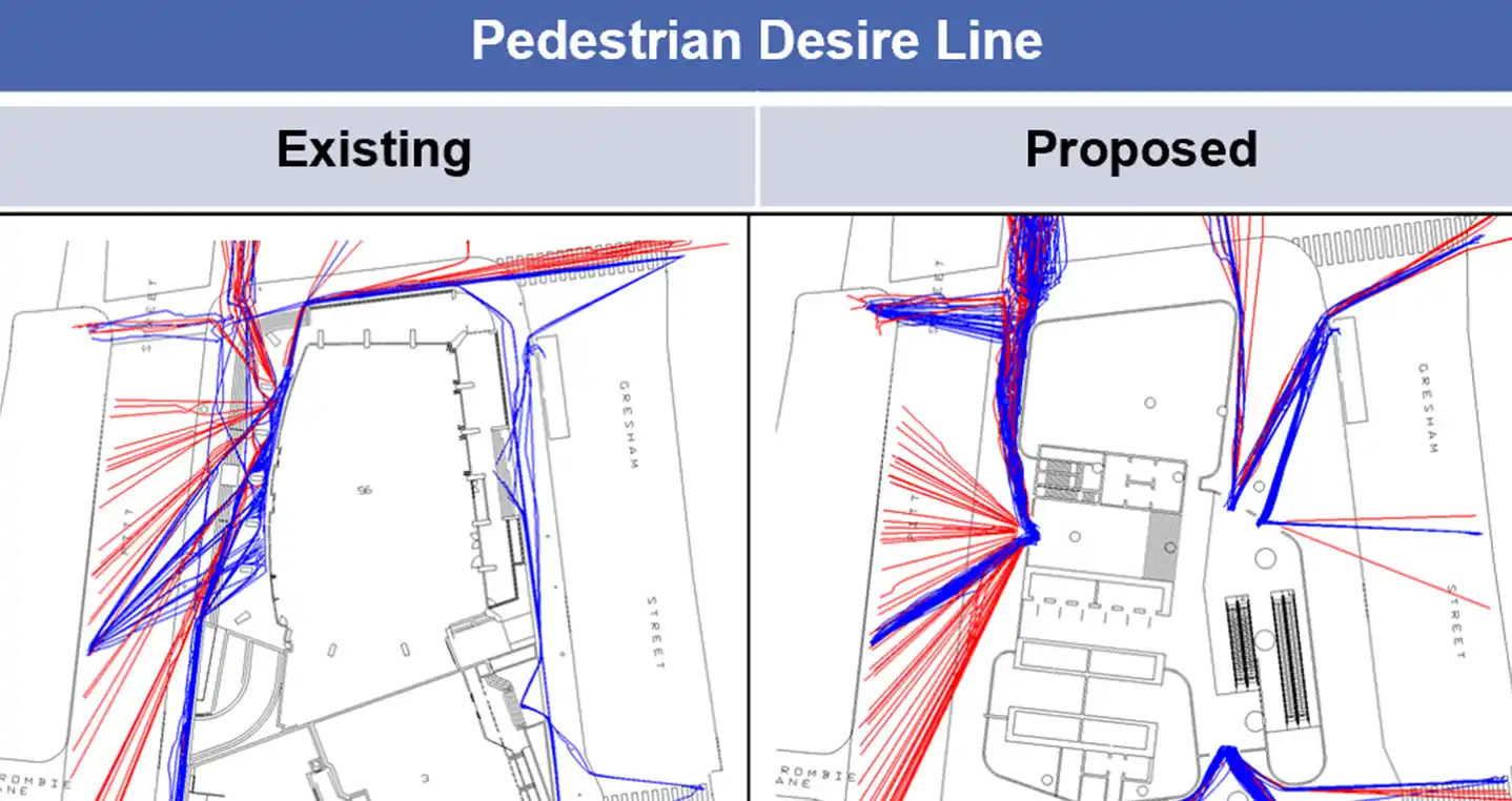
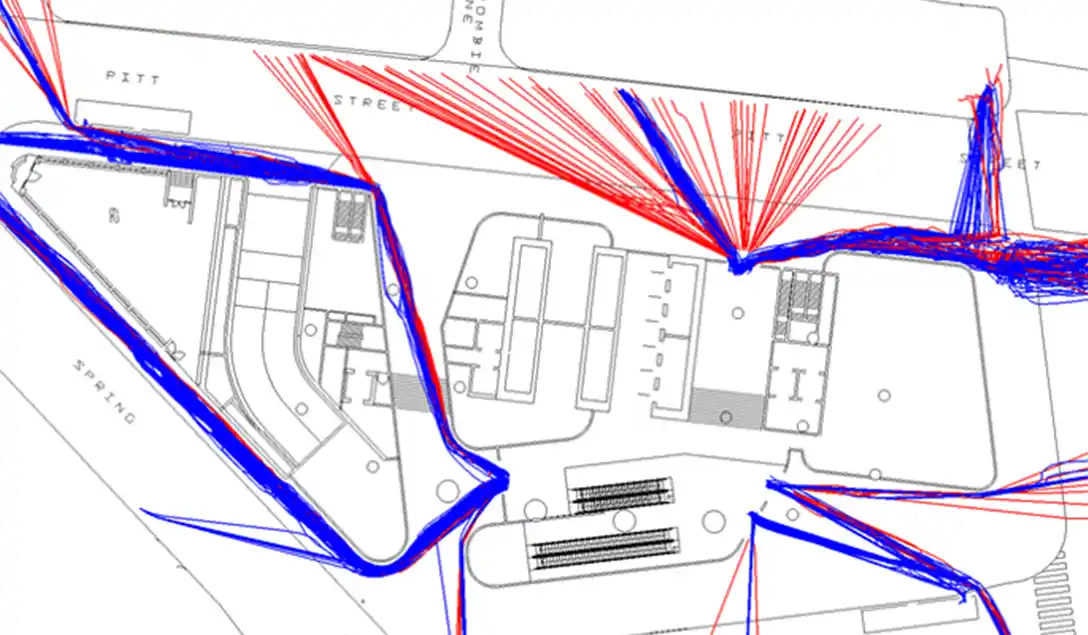
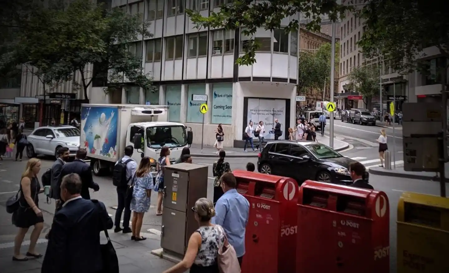
Ason Group was engaged to undertake the capacity analysis and assess the operational performance of the current and proposed design in terms of Level of Service provided to pedestrian circulation on the block and adjacent streets in Sydney CBD.

The Legion pedestrian model was developed to perform virtual experiments on the design and operation of the study site and assess the impact of different levels of pedestrian demand, including the capacity across a wide range of scenarios and explore how pedestrians and crowds interact with infrastructure.

Our work included

  • Profile of pedestrians boarding / alighting public transport and determining person-trip rates using various surveys.
  • Simulate the pedestrian movements at signalised crossings and on footways on the study precinct.
  • Measure the densities and Level of Service occurring in the site as well as on the surrounding streets and at pedestrian crossings.
  • Produce Cumulative Density maps describing the Level of Service (LoS) in each part of the stops during relevant time intervals.
  • Produces Desire-line maps describing the building-users routing for the modelled time.

Similar Projects

Ason Group was engaged by TfNSW to undertake multiple ITAP assessments including over 30 intersections and corridors across a range of locations in NSW. Ason Group proposed and successfully implemented the use of drone technology to record intersection operations and deliver a greater level of traffic movement insights not previously

View Details

Integrated Transport Action Plan (ITAP)

Ason Group has been engaged to undertake Traffic Modelling Assessment as a part of Transport Management & Accessibility Plan (TMAP) in support of the State Significant Development Application (SSDA) proposal for an industrial warehouse development at 1-3 Burrows Road, St Peters. Traffic Modelling Assessment was prepared to address the relevant

View Details

Burrows Road Traffic Modelling Assessment

The Mamre Road Precinct (MRP) forms part of the Western Sydney Employment Area (WSEA) and Aerotropolis was rezoned in June 2020 to permit industrial land uses across approximately 850 hectares of land and over 3.5 million square metres. Ason Group was engaged to work with key stakeholders including Transport for

View Details

Mamre Road Precinct – Road Network Assessment