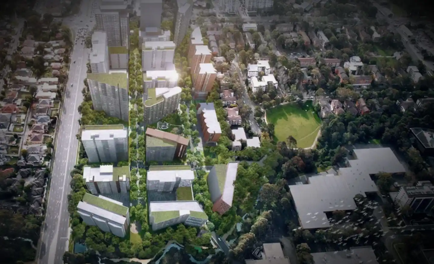
Victoria Road Corridor Analysis

Survey using Unmanned Aerial Vehicles (Drone) and TomTom GPS.

Real-time traffic data and impact forecasts.

Our work included

  • Telemetric data processing by Artificial Intelligence, including Operational Data (e.g. turn counts, queue length, signal phasing / timing, origin-destination) and Dynamic Behavioural Data (e.g. speed profile, acceleration, weaving, gap acceptance, headways, reaction time, lane utilisation, merging and diverting).
  • High quality video / images to demonstrate interaction amongst road users.
  • Calibration of traffic operation models.
  • Pinch point corridor analysis and speed profiles using historical data.

Similar Projects

Ason Group was engaged by Haben Property Fund to prepare a Traffic Impact Assessment to support a Planning Proposal for a mixed-use development at 33-43 Phillip Street, St Marys. Further to a proposed amendment to existing FSR provisions, the Site provides an indicative yield of: 584 residential units. 2,200m² GFA

View Details

Station Plaza St Marys

Ason Group was originally commissioned in 2017 to undertake the development assessment of the Master Plan for 45-61 Waterloo Road Macquarie Park, providing for some 117,000m2 of commercial GFA.Subsequently we have also been commissioned to provide Transport Assessments for the first 3 buildings, including Building C (now known as “The

View Details

Waterloo Road

Ason Group has been involved in the development assessment of numerous Goodman assets throughout the Western Sydney Employment Area (WSEA), including Oakdale Central, Oakdale South, Oakdale East and Oakdale West Industrial Estates. In support of the Construction Environmental Management Plan (CEMP) for Oakdale West, Ason Group was tasked to prepare

View Details

Oakdale West Precinct